About Catalin Cimpianu

Phd in Remote Sensing and GIS applied in hydrology and flood management, MSc in Geomatics and BSc in Spatial Planning at "Alexandru Ioan Cuza" University from Iasi, Romania. Experience in using different geospatial software products, (ArcGIS Desktop, QGIS), data collection, spatial analysis, manipulation of geographical information, map creation, etc.
13 04, 2018

How to create a Visibility Analysis with QGIS

By |2018-04-16T09:19:59+00:00April 13th, 2018|BLOG|1 Comment

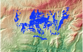
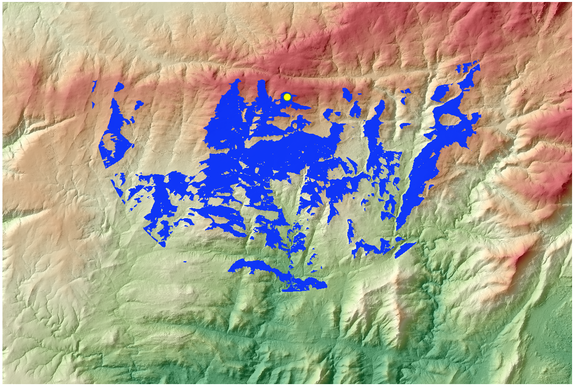
The view matters.  Visibility analysis are important from the planning point of view. Visual analysis tools allow you to generate visibility studies over an area, creating an output raster that display what entities can be seen over a certain landscape, from the point of view of one or more observatory. They are used mainly for the planning [...]

21 03, 2018

Simple example on how to work properly with Coordinate Systems in ArcMap

By |2018-03-21T14:33:49+00:00March 21st, 2018|BLOG|0 Comments

A coordinate system is responsible for displaying your data in the right location. Understanding how to properly work with Coordinate Systems can save unnecessary work and reduce the errors you may encounter in the development of the project. Lets see a simple example regarding this matter. We have two layers that represent the country limit [...]

7 03, 2018

Using Semi-Automatic Classification Plugin with QGIS 3.0

By |2018-03-07T10:34:36+00:00March 7th, 2018|BLOG|1 Comment

The Semi-Automatic Classification Plugin version 6.0, updated and designed to work with QGIS 3.0 has a new cool main interface, new tabs and intuitive design. In order to start working with satellite data and realize operations like download satellite data, preprocessing, band processing, postprocessing go to any of the following buttons as highlighted in the [...]

6 03, 2018

How to add OpenStreetMap Basemaps in QGIS 3.0

By |2018-03-07T10:38:13+00:00March 6th, 2018|BLOG|7 Comments

QGIS 3 has a new plugin architecture, meaning that plugins are not immediately available/compatible with this new version. The QGIS OpenStreetMap Plugin is a plugin for the desktop GIS application QGIS. With the release of the new QGIS 3.0 version this plugin it is not available yet. We will have to wait for a new release of the [...]

22 02, 2018

QGIS 3.0 will be released tomorrow 23.02.2018

By |2018-02-22T12:32:35+00:00February 22nd, 2018|BLOG|0 Comments

23.02.2018 it is a big day for all QGIS users. After a long wait QGIS 3.0 will be finally released. According to QGIS Road Map the new version will be launched tomorrow. Its really a big thing if we take into consideration that there has not been any major releases since 2013 when version 2.o came [...]

21 02, 2018

How to download and install PostGIS via OpenGeo Suite

By |2018-02-21T12:24:30+00:00February 21st, 2018|BLOG|0 Comments

OpenGeo Suite is a full geospatial software stack that helps you compose, style, publish, and manage maps and data with ease. You can get PostGIS/PostgreSQL and other web GIS utilities in a single and fast installation using the OpenGeo Suite package installer. If you do not want all OpenGeo Suite capabilities and software that come along [...]

6 02, 2018

EO Browser a web tool for Earth observations

By |2018-02-13T09:20:51+00:00February 6th, 2018|BLOG|5 Comments

Sinergise EO Browser is a free spatial data visualization tool which allows users to search and study a vast amount of satellite imagery. It brings together products like Sentinel-2 and Sentinel-3, ESA’s archive of Landsat 5, 7 and 8, global coverage of Landsat 8, and Proba-V. All of these can be found in the same place, providing a full resolution [...]

1 02, 2018

Use ArcGIS tools for 3D mapping – How to fill space between layers?

By |2018-02-01T16:55:56+00:00February 1st, 2018|BLOG|0 Comments

If you have two raster’s (digital elevation models) of the same area but they are displaying the area in two different moments of time, it is possible to fill up the space between them and obtain valuable data about the differences that occurred in time or due to an anthropic activity, for example a mining [...]

22 01, 2018

Simple methodology for water data extraction using QGIS and Sentinel 2 images

By |2018-01-23T08:40:37+00:00January 22nd, 2018|BLOG|1 Comment

Sentinel-2 satellite data proved to be a reliable source of information regarding the monitoring of Earth features and phenomena’s. With a 10 m geometric resolution is the best optical satellite data available free of charge. The temporal resolution is also performing well, the satellites in the Sentinel-2 constellation provide a revisit time of 5 days. [...]

Title

Go to Top