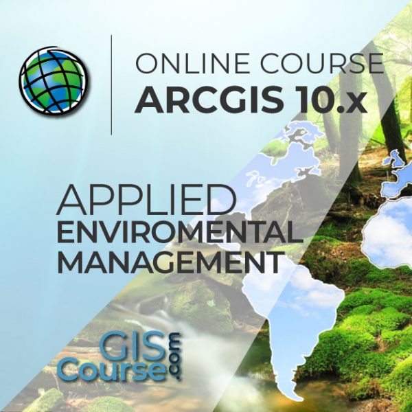
QGIS AND GRASS GIS COURSE, APPLIED TO ENVIRONMENTAL MANAGEMENT
ONLINE TRAINING
START DATE: AVAILABLE SOON (140 hours)
PRICE: 400 € (Standard fee) | 360 € (Student / Unemployed fee)

The objective of this course is to initiate the student in the management of QGIS, for the preparation of studies related to environmental management.
The student will acquire the necessaries skills in the manipulation of QGIS tools that are recommended in environmental studies and analysis (EIA, environmental papers, fauna studies, etc.). The student will be trained in the development of quality thematic cartography, multi-criteria spatial analysis with applicability in environmental management and in alternative analysis.
Enrolled students in this online course will have access to our virtual e-learning platform (which is available 24 hours), where they will find the content of the course, practical exercises, forum discussion and additional content. One of the advantages of this online platform, is that students can benefit of real time support and assistance offered by the instructor (2 hours per week), whom they can contact via direct messages, regarding course related issues, at any moment. They can also contact the instructor via email.
- Highlight the importance and utility of a Geographic Information System (GIS), its integration and applicability in environmental management.
- General overview about the basic skills needed in QGIS and GRASS GIS. Essential concepts used by a GIS system in environmental management projects elaboration.
- Learn about GIS key tools in an appropriate and professional way, usage of vector and raster data information, develop high quality cartography products, elaborate complex spatial analysis.
- Find about all possible difficulties which you may encounter in the execution of environmental GIS projects, and their solutions through practical exercises.
- Gain experience in data preparation, layout development, map creation and high quality products delivery.
- Skills acquired by the student during our course: management of field sampling spatial databases, fauna density maps, erosion studies, hydrological studies, environmental sensitivity maps.
1 - INTRODUCTION IN GEOGRAPHICAL INFORMATIONAL SYSTEMS
- Basic concepts and definitions
- Capabilities and applications of Geographic Information Systems
- Geographic information: vector data models, raster data models and other data models (CAD, TIN, etc.). Main characteristics, advantages and disadvantages of each data model
- QGIS graphic interface presentation
2 - ESSENTIAL OPERATIONS WITH VECTOR DATA
- Add layers, edit properties and attribute tables
- Add Web Services for Maps and Base Maps (OMS, Google Maps, Bing Maps)
- Examine data: Search for data, apply queries and filters
- Select by attributes, Select by location, data capture
- Symbology layers: single symbol, by categories, by quantities, using graphs
3 - COORDINATE SYSTEMS, PROJECTIONS AND IMAGE GEOREFERENCING
- Introduction to Coordinate Systems and Projections
- Definition of Coordinate System
- Coordinate Systems and Transformations
- Image georeferencing, CAD files and layers
4 - VECTOR DATA MODELS. GENERATE AND EDIT VECTOR DATA
- Create, edit and work with spatial data
– How to create spatial data, edit toolbar, digitization techniques
– Obtain new vector layers from OMS
– Convert CAD files to layers
– Edit existing layers
– Create layers from X, Y coordinates points - Working with attribute table, create and edit data
– Attribute table structure
– Types of data
– Edit table information
– Geometric calculations (surface, perimeter, length, etc.)
– Table statistics
– Table conversion, excel to other formats, reports and graphics generation
5 - VECTOR DATA MODELS. TABLE RELATIONS
- Database design
- Database connections, combine tables with UNION
- Spatial joins, generate new statistics and new data using table and spatial data information
6 - INTRODUCTION IN RELATIONAL DATABASES SYSTEMS
- Types of data that can be included in a database
- About installing PostgreSQL
- Create and manage data using PostGIS
7 - GEOPROCESSING TOOLS AND SPATIAL ANALYSIS USING VECTOR DATA
- Vector geoprocessing tools, feature extraction, proximity and overlay analysis
- Create sampling grids
- Multi-Criteria Analysis, zonal statistics, optimal site location
Practical Exercise 1 (environmental monitoring): Generating sampling grids for the study of population evolution and density.
8 - SPATIAL ANALYSIS USING RASTER DATA
- Conversion tools, raster, vector, ASCII, KML
- Generate digital models of elevation using vector data, ASCII and TIN files.
- Querying and masking raster data for obtaining new information
- Merging raster files
- Contour, slope, hillshade, aspect and visibility maps
Practical Exercise 2 (landscape): Landscape visibility mapping, viewshed analysis using high precision digital terrain models, define specific views.
9 - ADVANCED SPATIAL ANALYSIS USING RASTER DATA
- Reclassify rasters, euclidean distances, boolean operations on layers, raster aggregation and data conversion
- Map algebra (Raster calculator), mathematical operations between rasters, cell statistics
- Practical Exercise 3 (geomorphology/erosion): Assessment of soil erosion risk based on variables such as slope, soil type, presence of vegetation, etc.
- Data interpolation techniques (IDW, kriging, natural neighbor)
Guided Exercise 4 (fauna and vegetation): Creating density and distribution maps of vegetation and fauna using interpolation data techniques and data taken from the field or from literature.
10 - HYDROLOGICAL AND MULTICRITERIA ANALYSIS
- Hydrological study: drainage networks, flow direction, watershed basins, catchment areas
Practical Exercise 5 (hydrology): Determination of a drainage network in digital elevation models, predominant flow direction and flow accumulation, identification of drainage basins (sub and micro basin delineation).
- Performing Multicriteria raster analysis, basic concepts and weights (the most important component of the MCDA model), weighted layers’ combination, non-compensatory analysis, least cost path analysis
Practical Exercise 6 (analysis of alternatives): Multicriteria analysis for environmental sensitivity projects and impact studies (select best spatial variables and see the potential environmental impacts, select the option with the least environmental impact).
Practical Exercise 7 (analysis of alternatives 2): Select the best route (corridor) with minimum environmental impact using multicriteria analysis.
11 - INFORMATION SOURCES AND RESOURCES FOUND ON WEB
- Download digital maps (IGN), take advantages of WMS cartographic servers.
- IDEE (Infrastructura de Datos Espaciales de Espana) Portal for regional, european and international data
11 - INFORMATION SOURCES AND RESOURCES FOUND ON WEB
- Download digital maps (IGN), take advantages of WMS cartographic servers.
- IDEE (Infrastructura de Datos Espaciales de Espana) Portal for regional, european and international data
12 - MAP PRODUCTS
- Layout proprieties
- Insert map elements (legend, scale, north arrow, coordinate grid), Excel tables, data frames, images, graphs
- Export and print options
Practical Exercise 8 (map creation): Elaboration of quality thematic cartography products focused on environmental impact studies in concordance with INSPIRE Directive.


Alfonso Noriega Díaz
Why should we learn to use QGIS?
Geographic Informational Systems (GIS) are rapidly spreading and becoming an essential tool in many work fields including, engineering, environment, geography, geology and mining, emerging sciences, geomarketing. From all open source GIS software products, QGIS is the best due to, its large online support community, which always favor up to date status, continuous development of new capabilities, easy integration with other open source packages, improved performance with each release.
Do I need previous QGIS training?
No, the training course starts from the very beginning. You do not need any previous QGIS knowledge.
I do not have the software QGIS, what are my options?
QGIS it is a free, open source software that can be downloaded from the official website (http://www.qgis.org/en/site/). It is very simple to get and install it on your computer. However, in each course we have included a help manual that is come in handy if you want to download and install QGIS on your local machine.
Our online courses, are distributed via Moodle, the world’s most popular learning platform. It is a highly flexible Learning Management System that can be used to conduct and access courses, accomplish tasks of practical exercises, interact face-to-face to the teaching staff or benefit of support and resources at any time.
The online platform can be accessed 24 hours a day, in which the student will be able to ask for help at any given moment. The instructors will act as supervisors during all the training process, offering support for any possible difficulty encountered by the students along the course.
The course is structured in different modules, making it easy for the student to search for training material, download information, complete practical exercises and take assessments in order to verify their new gained abilities. The instructors will assist the students throughout all the course period, offering progressive help and information according to their evolution.
400 € (Standard fee) / 360 € (Student / Unemployed fee)*
*To enjoy this discount, you must include a copy of a document that proves your situation along with the registration form.
** If you want to know the price in other currencies, you can consult the following online converter: The Money Converter

Step 1. Request your registration to the training course completing the pre-registration document (Registration Form) and send it via email to training@tycgis.com.

Step 2. As soon as we receive it, we will send you an enrolment guide with the complete information to enroll in the course: dates, schedule, software needed for the course and the installation guide. The payment methods are included in this document.


Step 4. Once we receive the receipt, we will confirm your registration to the course via email.


NATIONAL WIRE TRANSFERS (INSIDE SPAIN):
ACCOUNT NUMBER: 0049 1809 222710347481 (Banco Santander)
BENEFICIARY: TYC GIS Soluciones Integrales SL
SUBJECT: “Student Name” and QGIS ENVIROMENT COURSE ON
INTERNATIONAL WIRE TRANSFERS:
BANK NAME: Banco Santander
BANK ADDRESS: Glorieta Ruiz Jiménez 1, 28015 Madrid (España).
BENEFICIARY: TYC GIS Soluciones Integrales SL
BENEFICIARY ADDRESS: Calle Fuencarral 158, Entreplanta, Oficina 16-17 28010 Madrid (España).
ACCOUNT NUMBER: ES90 0049 1809 222710347481
SWIFHT: BSCHESMM – IBAN: ES90
If you have payment difficulties, contact us

 (33 votes, average: 4.21 de 5)