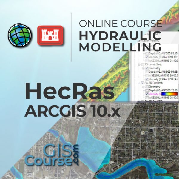
HECRAS AND ARCGIS 10.x COURSE FOR HYDRAULIC MODELLING (GEORAS)
ONLINE TRAINING
START DATE: AVAILABLE SOON (80 HOURS)
PRICE: 240€ (Standard fee) | 216€ (Student / Unemployed fee)
-01")
This course will qualify students in HECRAS and ArcGIS extension HEC-GEORAS one of the most known and used software in hydraulic modelling.
Students will be trained in the basics of hydraulic modelling of prismatic channels and non-prismatic/natural riverbeds, as well as how to simulate different hydraulic constructions. The student will also learn how to use the ArcGIS – HEC-geoRAS extension, estimate different hydraulic parameters and define a simulation environment.
Enrolled students in this online course will have access to our virtual e-learning platform (which is available 24 hours), where they will find the content of the course, practical exercises, forum discussion and additional content. One of the advantages of this online platform, is that students can benefit of real time support and assistance offered by the instructor (2 hours per week), whom they can contact via direct messages, regarding course related issues, at any moment. They can also contact the instructor via email.
- Become qualified in HECRAS and ArcGIS extension (HEC-geoRAS) one of the most known and used hydraulic modelling software.
- Highlight the importance and utility of hydraulic simulation models.
- Understand all the essential concepts that are used in HECRAS.
- Find about HECRAS capacity in the flow modelling in artificial and natural water courses through practical exercises.
- Demonstrate how floods can be modified through the introduction of different engineering works over the course of a river.
- Discover the possibilities offered by HEC-geoRAS when processing georeferenced data in order to to facilitate the import of a project done with HEC-RAS in ArcGIS environment.
- Improve your skills and gain experience in data preparation, layout development, map creation and high quality products delivery.
1- BASIC CONCEPTS OF HYDRAULIC MODELLING
- Introduction
- Open channel movement of a fluid.
- Concepts of Energy Height and Head losses.
- Manning formula for channels
- Variable, permanent, varied and Uniform flow regime
- Control sections and Boundary conditions
Guided exercise: Understand the basic concepts
2 - FIRST STEPS. INTRODUCTION TO HEC-RAS
- Introduction
- HEC-RAS mathemtical and phisical principles
- Advantages and disadvantages of the program.
- Software installation.
3 - BUILDING A BASIC HYDRAULIC MODEL IN HEC-RAS
- Introduction
- Initial interface
- Creating a new project
- Definition of geometry
- Defining the flow and boundary conditions
- Simulation
- Viewing the results
- Location of geometry and flow files in windows
- Checking calculations
Guided exercise: How to build a basic hydraulic model in HEC-RAS.
4 - ADVANCED GEOMETRY
- Introduction
- Cross sections editing tools from the options menu.
- Manning coefficients definition
- Definition of structures in cross sections
- Using quick data tables
- Cross Section Interpolation
- Section inversion.
- Importing geometries
Guided exercise: Working with geometries.
5 - DIGITAL ELEVATION MODELS AND ARCGIS
- Introduction to ArcGIS
- Using ArcGIS to create a Digital Elevations Model.
- ArcGIS Hydrologic tools
- Summary of processes
Guided exercise: Integration with ArcGIS.
6 - CREATING AND IMPORTING GEOMETRIES USING GeoRAS
- Introduction
- Downloading and activating the GeoRAS extension in ArcGIS
- Generation of a geometry
- Exporting geometries to HEC-RAS
Guided exercise: Create and import geometries.
7 - MODELLING HYDRAULIC WORKS
- Introduction
- Theoretical bases
- Bridges and culverts
- Inline structures, weir and gates.
- Lateral structures
- Multiple reaches and junctions in channels and rivers.
Guided exercise: Input parameters for a hydraulic model.
8 - ADVANCED DEFINITION OF THE FLOW REGIME
- Introduction
- Previous theoretical concepts
- Editing flows and profiles in steady flow regime
- Boundary conditions
- Plans and hypothesis
- Simulation
Guided exercise: Flow simulation.
9 - VIEWING RESULTS
- Introduction
- Output tables
- Profiles and cross sections diagrams
- Graphics
- Three dimensional channel views
Guided exercise: Exploring the results.
10 - WARNING AND ERRORS
Introduction
Identifying errors
Identifying alarms and notifications
Conclusions

Martín Núñez Pérez
Civil engineer with specialization in Hydraulics and Energy, several years of experience in drafting hydraulic works, technical consulting in hydrology and design of hydraulic works and management of geographic information systems.
He has participated in many projects of hydraulic and hydroelectric infrastructures of national and international scope, as much in hydrological planning as in design and dimensioning of hydraulic infrastructure. In the professional field, has specialized in the management of various types of hydraulic and hydrological modeling software as well as for the sizing of hydraulic works
Why study Arcgis / GeoRAS and HEC-RAS?
The usage of Geographic Information Systems (GIS) is rapidly growing, becoming an essential tool in a variety of business sectors like engineering, environment, geography, mining or geomarketing. Among GIS tools, ArcGIS is one of the most used GIS software worldwide, the most stable and versatile, comprised by a set of integrated applications, with a solid documentation over a wide range of tools being also supported by a large community.
HEC RAS is a simple and intuitive hydraulic modelling program that allow simulating the behaviour of a river/channel taking into account the morphology, slope and type of riverbed. In its calculations we can include also infrastructures like water intakes, bridge pillars and terrain. It allows us to estimate the water reach points, evaluating the flood hazards and learn about the flood risk areas etc. In addition, using this software, we can correctly determine the location of the new defense hydraulic infrastructures.
HEC-GeoRAS is an extension for ArcGIS that facilitate the connection between HECRAS and ArcGIS. Its capabilities include the extraction of ArcGIS data to obtain the riverbed morphology, type of terrain and so on. Once the simulation is done in HECRAS, we can import, visualize and handle the results directly in ArcGIS.
Do I need previous knowledge?
No, the training course starts from the very beginning. However, having prior knowledge of ArcGIS may be beneficial.
I don’t have ArcGIs 10. X, HEC-RAS and GeoRAS programs. What can I do?
Due to changes in the ESRI licensing policy, the trial version of 60 days for ArcGIS – ArcMap it is not available anymore. You can get access to the full capabilities of ArcGIS platform with the new ArcGIS for Personal Use option available at the following link.
HEC-RAS and GEO RAS are programs developed by the US Corps of Engineers and available for download on their website: HEC-RAS and GeoRAS.
Our online courses, are distributed via Moodle, the world’s most popular learning platform. It is a highly flexible Learning Management System that can be used to conduct and access courses, accomplish tasks of practical exercises, interact face-to-face to the teaching staff or benefit of support and resources at any time.
The online platform can be accessed 24 hours a day, in which the student will be able to ask for help at any given moment. The instructors will act as supervisors during all the training process, offering support for any possible difficulty encountered by the students along the course.
The course is structured in different modules, making it easy for the student to search for training material, download information, complete practical exercises and take assessments in order to verify their new gained abilities. The instructors will assist the students throughout all the course period, offering progressive help and information according to their evolution.
300€ (Standard fee) /270€ (Student / Unemployed fee)*
*To enjoy this discount, you must include a copy of a document that proves your situation along with the registration form.
** Si desea conocer el precio en otras monedas, puede consultarlo en el siguiente conversor online: The Money Converter

1st step. Request your registration to the training course completing the pre-registration document and sending it via email to training@tycgis.com.

2nd step. As soon as we receive it, we will send you an enrolment guide with the complete information to enrol in the course: dates, schedule, software needed for the course and the installation guide. The payment methods are included in this document.


4rd step. Once we receive the receipt, we will confirm your registration to the course via email.


TRANSFERENCIAS NACIONALES:
ACCOUNT NUMBER: 0049 1809 222710347481 (Banco Santander)
BENEFICIARY: TYC GIS Soluciones Integrales SL
SUBJECT: “Student Name” and GIS HECRAS COURSE ON
TRANSFERENCIAS INTERNACIONALES:
BANK NAME: Banco Santander
BANK ADDRESS: Glorieta Ruiz Jiménez 1, 28015 Madrid (España).
BENEFICIARY: TYC GIS Soluciones Integrales SL
BENEFICIARY ADDRESS: Calle Fuencarral 158, Entreplanta, Oficina 16-17 28010 Madrid (España).
ACCOUNT NUMBER: ES90 0049 1809 222710347481
SWIFHT: BSCHESMM – IBAN: ES90
Si tiene dificultades para realizar el pago, contacte con formacion@tycgis.com

 (22 votes, average: 4.41 de 5)