INTRODUCTION IN PROGRAMMING USING GOOGLE MAPS API
ONLINE TRAINING
START DATE: AVAILABLE SOON (60 hours)
PRICE: 250 € (Standard fee) | 225 € (Student / Unemployed fee)
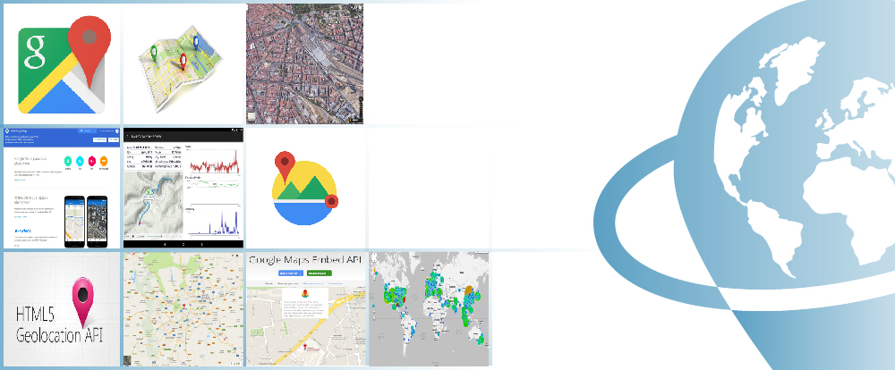
The course topics aims to cover the most important aspects of Google Maps API mapping potential, highlighting the easiness of how dynamic web maps can be developed.
The student will get through the basics of API Programming, the implementation of different types of tools, the incorporation of different data formats derived from different sources, the creation of events, the use of Geocoding process and the handling of Google Elevation service.
Enrolled students in this online course will have access to our virtual e-learning platform (which is available 24 hours), where they will find the content of the course, practical exercises, forum discussion and additional content. One of the advantages of this online platform, is that students can benefit of real time support and assistance offered by the instructor (2 hours per week), whom they can contact via direct messages, regarding course related issues, at any moment. They can also contact the instructor via email.
- Get familiar with Google Maps API and with the features and functionalities that can help you create a cartographic viewer.
- Demonstrate which are the essential Google Maps API tools and how they work, in order to learn how to carry out practical applications and execute the necessary actions in different projects.
- Introduce and teach the student in the programming language used by Google API.
- Work with services and events associated with the API, in order to allow the improvement of web mapping functionalities and capabilities.
- Practice your new developed skills through practical exercises and examples provided by our instructors.
1 - INTRODUCTION TO PROGRAMMING USING GOOGLE MAPS API
- Google Maps capabilities
- Free for non-commercial use
- Google Maps Premier license
- Basic Map-Code
- Google Maps API versions and releases
- Browsers compatibility
- Google Maps API documentation
2 - BASIC CONCEPTS OF GOOGLE MAPS API
- How to create a map?
– Importing data into Google Maps API
– Create Google Maps Container
– Customize map options and create a new map object (using Map Object)
– Load the map with an initialization function - Create custom controls for the map
- GUI, Default Graphical User Interface/ The Default UI
- Add custom controls to the map
- Configure Controls
- Control positioning
– Zoom level control
– Navigation controller (Pan tool)
– Toggle between map types (MapTypeControl)
– Guide map control (OverviewMapControl)
– Scale control (ScaleControl)
– StreetView control (StreetViewControl) - Adding custom map overlays
- Remove an overlay
- Putting interactive markers in Google Maps API
- Simple bookmark icons
- Complex icons
- Google Maps icon collection
- Info Windows for markers
- InfoWindow class
- Add various shapes to your map: Polylines and Polygons, Circles, Rectangles
- Ground Overlay option
- Use map layers – general overview
- KML Layers – Display and manage KML layers
- KML and GeoRSS Layers
- Google Fusion Tables (FusionTablesLayer object), Fusion Table Queries
- Creating a heat map using Fusion Tables
- Traffic Layer
- Bicycling layer
3 - MAP EVENTS
- What are the events?
- Manipulate the events
- Handling Events, Do I have to respond to each event?
- Types of events
- User interface events (UI Events)
- Model-View-Controller Events (MVC Events)
- Registering Events
- Accessing arguments in UI events
- Removing Event Listeners
4 - GOOGLE MAPS GEOCODING API
- What is geocoding?
- The geocoding process
– The GeocodeRequest object
– The Geocoder object
– The GeocoderResults object
– The GeocoderAddressComponent object
– The GeocoderGeometry object
– The GeocoderLocationType object
– Status Codes - Reverse Geocoding. Results
5 - GOGGLE ELEVATION SERVICES
- Introduction to Google Maps Elevation service
- Elevation service processes
- Elevation Requests
- The ElevationService object
- The ElevationResult object
- The ElevationStatus object
- Example


Alberto Santos Estévez
Consultant and Geospatial Developer with more than 15 years’ experience in GIS integrated solutions and high performance systems.
Chencho Martín Lagunas
GIS Developer with extensive experience in Full-Stack software development, specialized in GIS data analysis and pre-processing using Python.
Why starting to study ArcGIS 10.x?
The usage of Geographic Information Systems (GIS) is rapidly growing, becoming an essential tool in a variety of business sectors like engineering, environment, geography, mining or geomarketing.
Among GIS tools, ArcGIS is one of the most used GIS software worldwide, the most stable and versatile, comprised by a set of integrated applications, with a solid documentation over a wide range of tools being also supported by a large community.
ArcGIS provides contextual tools for data visualization, mapping and spatial analysis, connecting and combining information from varied sources (local and online), offering complex capabilities in order to explore, gain and enquire knowledge, that will lead to the best decisions. It can be also handled using a user interface as well as in command line using specific programming languages, like Python.
Do I need previous knowledge in ArcGIS 10.X?
Yes, for undertaking this course you will need previous Geographical Informational Systems training and knowledge.
I do not have ArcGIS 10.x software. What can I do?
ESRI (creators of the ArcGIS program) provides a free trial license for a 2 month. You only need to create an account, download the program and follow the installation steps (see the website). However, we will assist you in any problem you may encounter.
Our online courses, are distributed via Moodle, the world’s most popular learning platform. It is a highly flexible Learning Management System that can be used to conduct and access courses, accomplish tasks of practical exercises, interact face-to-face to the teaching staff or benefit of support and resources at any time.
The online platform can be accessed 24 hours a day, in which the student will be able to ask for help at any given moment. The instructors will act as supervisors during all the training process, offering support for any possible difficulty encountered by the students along the course.
The course is structured in different modules, making it easy for the student to search for training material, download information, complete practical exercises and take assessments in order to verify their new gained abilities. The instructors will assist the students throughout all the course period, offering progressive help and information according to their evolution.
250 € (Standard fee) / 225 € (Student / Unemployed fee)*
*To enjoy this discount, you must include a copy of a document that proves your situation along with the registration form.
** If you want to know the price in other currencies, you can consult the following online converter: The Money Converter

Step 1. Request your registration to the training course completing the pre-registration document (Registration Form) and send it via email to training@tycgis.com.

Step 2. As soon as we receive it, we will send you an enrolment guide with the complete information to enroll in the course: dates, schedule, software needed for the course and the installation guide. The payment methods are included in this document.


Step 4. Once we receive the receipt, we will confirm your registration to the course via email.


NATIONAL WIRE TRANSFERS (INSIDE SPAIN):
ACCOUNT NUMBER: 0049 1809 222710347481 (Banco Santander)
BENEFICIARY: TYC GIS Soluciones Integrales SL
SUBJECT: “Student Name” and API GOOGLE COURSE ON
INTERNATIONAL WIRE TRANSFERS:
BANK NAME: Banco Santander
BANK ADDRESS: Glorieta Ruiz Jiménez 1, 28015 Madrid (España).
BENEFICIARY: TYC GIS Soluciones Integrales SL
BENEFICIARY ADDRESS: Calle Fuencarral 158, Entreplanta, Oficina 16-17 28010 Madrid (España).
ACCOUNT NUMBER: ES90 0049 1809 222710347481
SWIFHT: BSCHESMM – IBAN: ES90
If you have payment difficulties, contact us

 (21 votes, average: 4.48 de 5)