In this demonstration we are going to show the steps for calculating a Relative Relief from a Raster in “.asc” format, DTM.
To start with, the relative relief represents the actual variation of altitude in a unit area with respect to its local base level, in other words, the difference in height between the highest and the lowest points in a determined surface grid areas.
Once we have results for every Pixel, these are classified according to the relief factor in some parametric values well defined.
So, firstly, we should have data referred to that difference in height. But what if we haven’t got any data apart from the Raster? We extract it from this Raster.
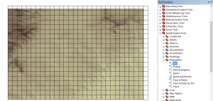
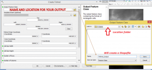
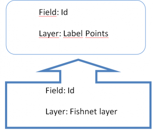
The first tool to use is the CREATE FISHNET tool (we used it in this post). It creates points (if the option is selected) and polygons (again, if the option is selected) but without any information in the attribute tables. Take note of the following images to know how it works:
![]()
![]()
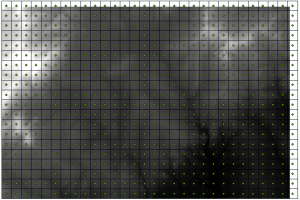
This is the result:
For further geoprocesses, we have to edit the new attribute table of the fishnet polygon and attribute table of the label corresponding to the fishnet, making its Id = [FID] + 1 using Field Calculator (right click on Id and select “Field Calculator”)
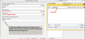
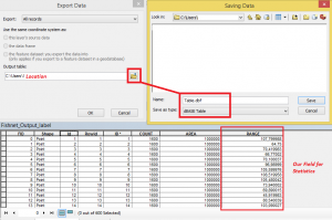
Next, we will extract the statistics for each cell of the raster. There is a special tool: ZONAL STATISTICS AS TABLE, and configure all the parameters for this tool. The next image is a model to look at:
As we will use points for a interpolation, we will do a Table Join, because the Fishnet layer has the information, not the label points. Then, right click on the point layer and Joins and Relates > Join.
We will make this join:
Export that table to dBase table, as seen on the next Image:
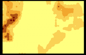
Finally, execute the IDW Interpolation tool, where the Z value is the recently exported table (Dbase).
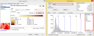
The result is a raster, and the final classification has 5 classes.
Quality training teached by professionals
RECOMMENDED COURSE


Leave A Comment