To improve the quality of our map, it is important to know that it is possible to customise the symbology, this means, to get the features adapted to what we want to represent on the map.
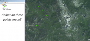
As an example, we will study the possibility of using a proper symbology for bear sights. Then, ArcMap is beign used to change the typical symbology of point to bear images.
We search for an image of a bear on Internet:
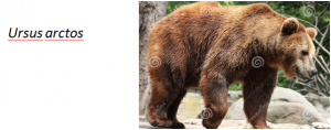
Optionally, we can do some modifications to its colours in order to have better image properties so that it will have a better contrast to the basemap. But the most convenient modification to do is to erase the image background. By doing this, the image won’t have any opacity for the basemap. Finally, save the image in .PNG format.
Open ArcMap and select from Table of Contents the symbol that has to be changed.
Double click on it and Symbol Selector window opens. Select Edit Symbol.
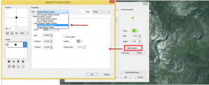
In Symbol Property Editor, choose Picture Marker Symbol in Type option
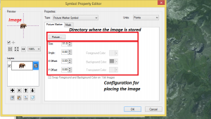
As we load the image we want to symbolize on the map, we are able to configure some parameters: Size, X Offset (distance from the point where the image is placed, horizontally) and Y Offset (distance from the point where the image is placed, vertically) and angle (degrees of rotation of the image).

Press OK twice and see the next result:
Thank you for your attention !
Quality training taught by professionals
RECOMMENDED COURSE


Leave A Comment