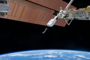
Imagine satellite´s images from the Earth being updated on a daily basis, offering high resolution pictures. Nowadays this is happening thanks to start ups focused on launching mini satellites to the Earth´s orbit, costing far less and providing images at a faster rate than traditional satellites.
This is the case of the disruptive start up Planet labs. Based in San Francisco, CA and founded in 2012, its purpose is to provide humanitarian aid with almost real-time information as stated on its website: “Fresh data from any place on Earth is foundational to solving commercial, environmental, and humanitarian challenges”.
Take a look at Will Marshal´s (CEO and Co-Founder of Planet labs) TED Talk – Tiny satellites show us the Earth as it changes in near-real-time.
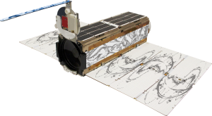
Planet labs designs and develops mini satellites, called Doves, which travel to low Earth orbit being able to complete a full Planet´s tour in 90 minutes at the same time as they capture images from the Earth. These images are received in a ground station and delivered via their cloud to their API and web tools for partners and customers.
As of today, 71 doves powered by solar energy have been launched to space, creating the biggest constellation of Earth imaging satellites on the world.
These satellite images provide fast response to change on a daily basis taking photos of every part of the Earth.
We can already start seeing that its applications are huge (land use, crop monitoring or logistics, to name some examples) and interested industries in using these data are agriculture, government, natural resources and geospatial information.

Keep River Mangroves – Australia
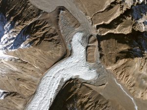
Yazghil Glacier – Pakistan
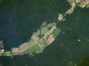
Trans Amazonian Highway – Brazil
Earth satellite images will help us answer questions such as the effects of climate change, waste management or deforestation, helping us take care of the World with more transparent and precise information to make the best decisions.
Quality training taught by professionals
RECOMMENDED COURSE


Leave A Comment