It is clear that GeoAI is here to stay. The use of Artificial Intelligence with geospatial information makes work easier, ensuring the smooth-running of complex workflows.
PEARL is a platform developed by “Development Seed” that make use of AI to quickly and effectively run LULC mapping workflows.
As a user you can access the platform for free and see how it works. In order to explore its capabilities we need to register first. To do that, press the Sign Up to Start Mapping and fill in the information required.

Once your account is created and you managed to log in, click on the Launch App button.
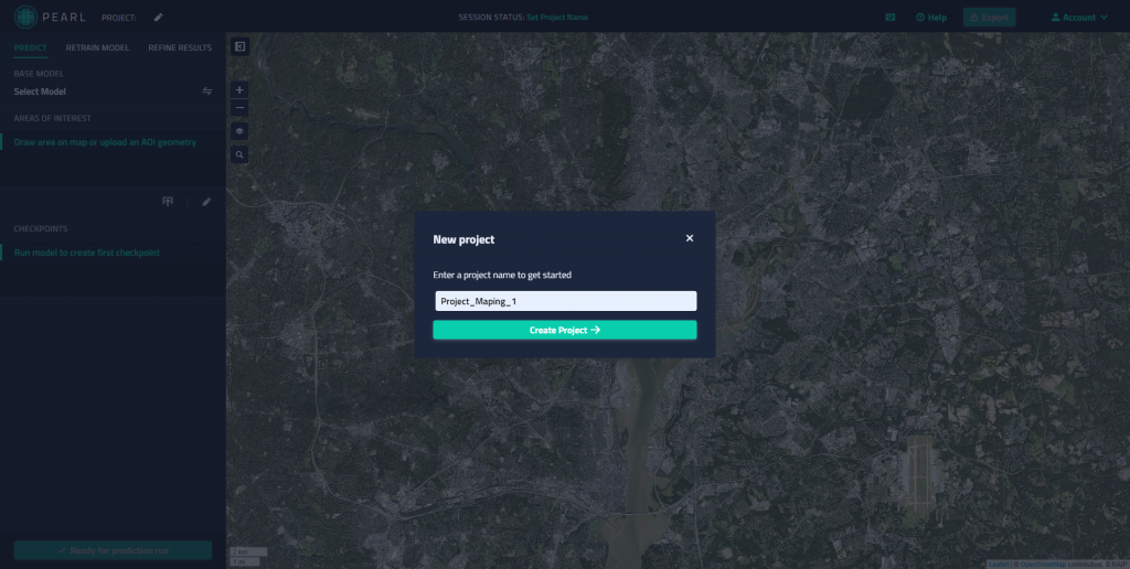
Now we can start exploring the application, first we need to give a name to our project.
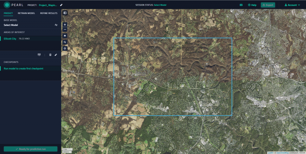
Once the project is created, we have to draw an area of interest in the map or just upload a GeoJSON file that capture our area of interest (AOI).
Please note that you can only work in certain areas (located in the United States) and the area of interest (AOI) is limited to 100 square kilometres. We will zoom in to an AOI next to the city of Baltimore. Using the Draw area of interest button sketch an area below 100 square kilometres.
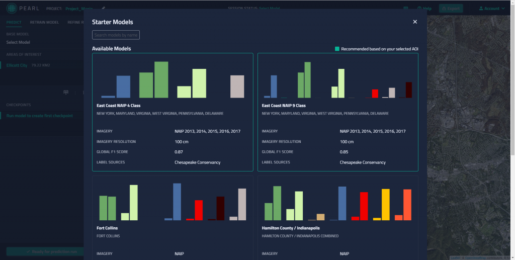
Next, go and select a Starter Model. In this screen display you can find more information about the data used by the model, class distribution, training areas, etc.
Once the model is selected, click on Ready for prediction run. Now wait until the predictions are ready and the LULC map for your AOI is generated.
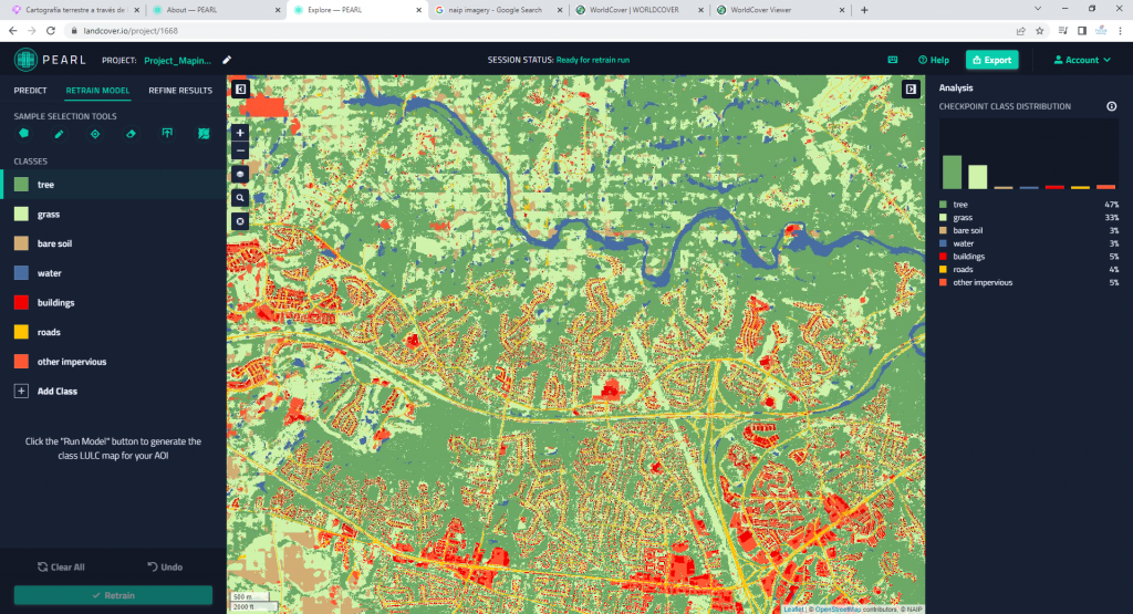
By going to the Refine Results you can refine your results.
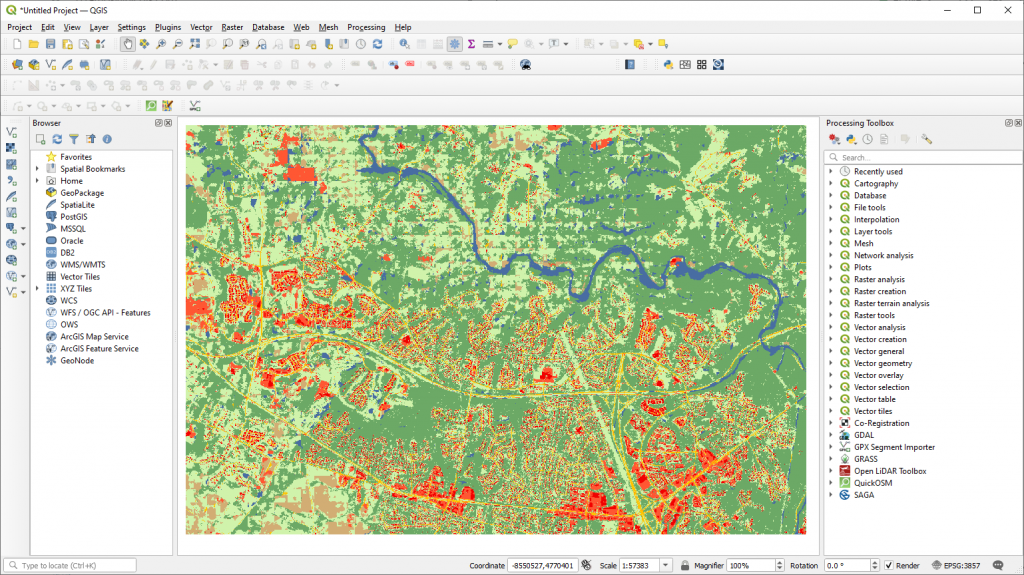
Also, by selecting the Export button we can export and download the LULC map on our computer (.tiff format) and use it in QGIS (for example).
PEARL is an easy way to get LULC data for your projects.
 (2 votes, average: 5.00 de 5)
![]() Loading...
Loading...
High quality and professional training
Recommended courses


Sources:
Original post: PEARL: plataforma que cartografía la cobertura terrestre a través de Inteligencia Artificial – https://www.cursosteledeteccion.com/pearl-plataforma-que-cartografia-la-cobertura-terrestre-a-traves-de-inteligencia-artificial/
PEARL Planetary Computer Land Cover Mapping – https://www.landcover.io/about#guide-models


Leave A Comment