Here is an easy way to download Google Maps orthophoto data on your computer using QGIS.
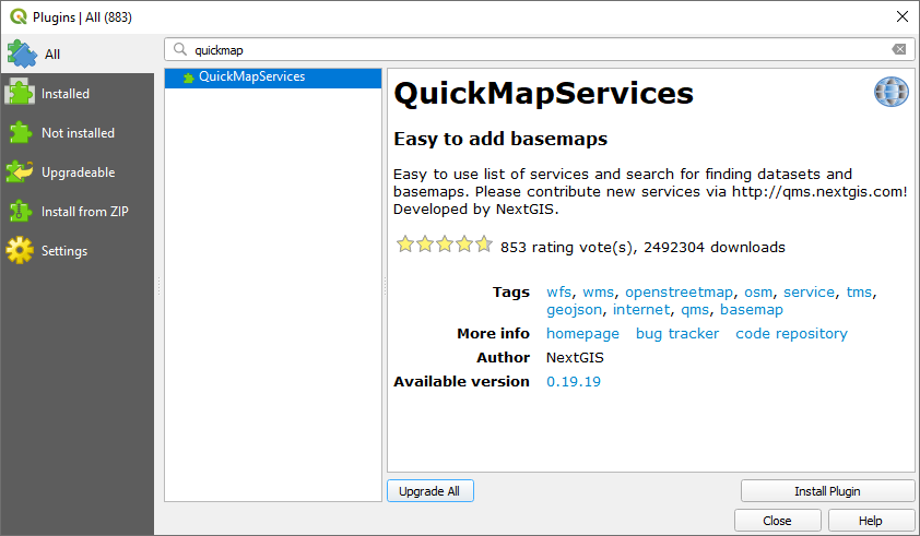
- First of all, you need to open QGIS and install the QuickMapServices plugin. Go to Plugins > Manage and Install Plugins > In the Search option type QuickMapServices.
2. Go to Web > QuickMapService > Search QMS and type Google Satellite.
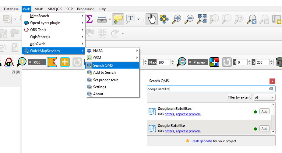
3. Click on Add button. The Google Satellite service will be added in your map canvas.
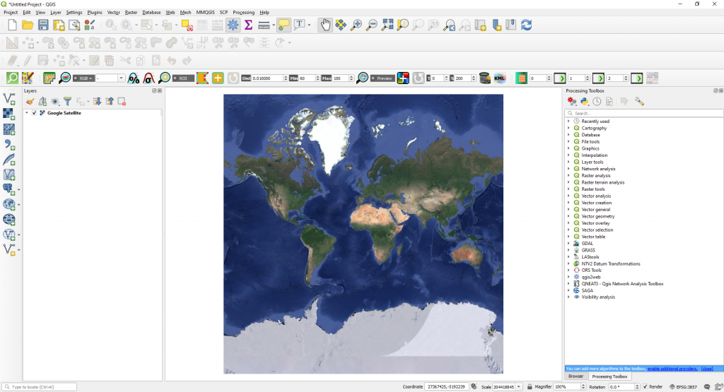
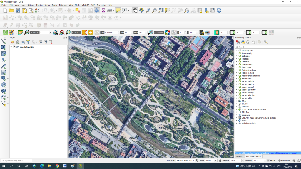
4. Navigate to your area of interest.
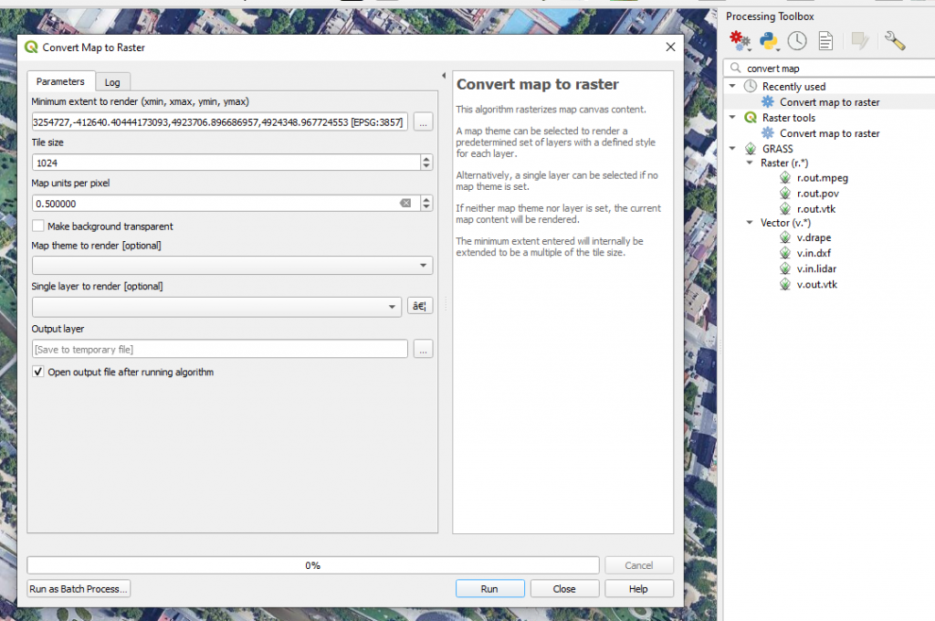
5. In the Processing Toolbox type Convert Map to Raster. This algorithm rasterizes map canvas content and save it on your computer. In the Parameters, set the extend to render, the tile size and the map units per pixels (spatial resolution). Also choose a location for the output layer. Click Run.
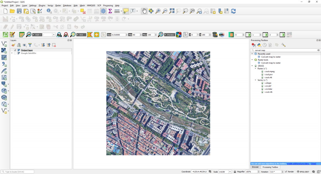
6. The extend to render set earlier is saved into your computer.
Recommended courses:


Thanks, worked perfectly. Really easy to follow steps and glad to have Google earth imagery working in QGIS now!
Great article