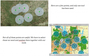
It is possible to string geoprocesses together by programming. This capability is used to get specific results: for a concrete spatial analysis or to manage a great amount of spatial data on desktop applications.
Python is the programming language available for ArcGIS to execute its tools, stored in Toolboxes, for geoprocessing.
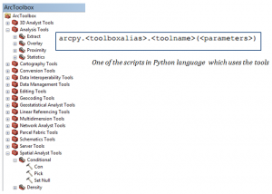
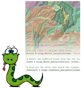
You can use these scripts by installing ArcPy, which is already included in your ArcGIS desktop download. It is the ArcGIS library for executing Python language. This library contains classes, functions and modules and provides all the functionality.
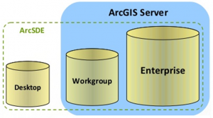
Nevertheless, Python can go further from ArcGIS Desktop: We can interact with the ArcSDE spatial database using database managers, no matter which, (DBMS: IBM DB2, IBM Informix, Microsoft SQL Server, Oracle, or PostgreSQL.) accessing with the following ArcPy class: ArcSDESQLExecute.
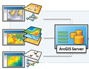
Upload your geoprocesses and analysis from ArcSDE to ArcGIS Server. Here, it is possible to do geoprocessing services, geodata services, map services and so on, sharing your work and/or getting the web applications or mobile applications to request data and information from the server.
This and even more functions, always carried out by using Python! There are specific tools for ArcGIS Server, you just need to download them from the following link:

Python is a powerful resource in ArcGIS.
If you already know the tools and how to execute the basic geoprocessing proceses, improve your knowledge in our next course release, Advanced Python in ArcGIS, where you will learn as well new classes and modules of ArcPy, to manage and share all your information from the server and get ahead in ArcGIS technology.
Quality training taught by professionals
RECOMMENDED COURSE


Leave A Comment