By georeferencing we refer to the process of spatially adjusting a CAD drawing without modifying its original data. In ArcGIS, such process is done registering arbitrary points in the CAD drawing, therefore drawing known geographic coordinates.

CAD files georeferencing is similar to the georefencing of images except for 3 distinguished features:
- Even though CAD data are composed by several files inside a table of contents, you only have to select one of them and the georeferencing will be applied to all of them.
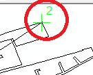
- You can only include 2 points. If you have to rotate the image, it will be done using the tool.
- Unlike images, where it is done automatically, you will have to click Auto Adjust to apply the transformation.
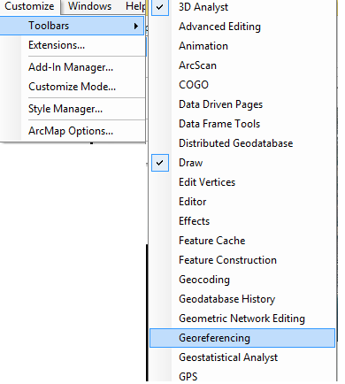
Firstly we will activate the georeferencing toolbar if it is not already activated:
Customize (in the toolbars tools) > Toolbars > Georeferencing
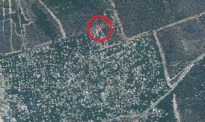
We will see in the screen the file prepared for georeference (choose one of the files forming the CAD file) and we will use the option Add Control Points to mark the CAD file first and then that same spot in the orthophoto.
The green cross will be used to “indicate” and the red one to “locate”.
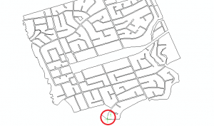
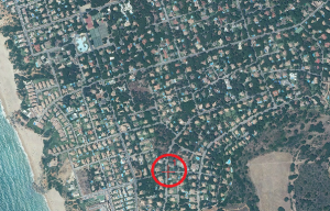
Using only 2 points:
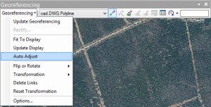
Finally select Georeferencing > Auto adjust, and it will appear located.
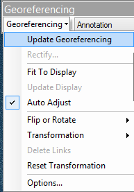
Once finished, go to Georeferencing > Update Georeferencing.
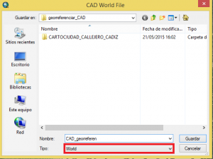
Once the georeferencing is done, it will generate a word file with the coordinates. It is very important to keep this file with the rest of CAD files so the georeferencing is not lost.
Quality training taught by professionals
RECOMMENDED COURSE


Leave A Comment