The Specialist ArcGIS 10.x and ArcGIS PRO Courses, will provide you with advanced knowledge regarding the main tools included in ArcGIS Desktop, the most extended and demanded software in the GIS labour market.

First of all, we will help you gain solid foundation regarding projections, coordinate systems and the types of data that you will be able to manage. Once you overcome this, you will learn to create and edit your own geo-located information and represent it in a quality map ready for printing or online publishing.

Figure 1: Locating schools and metro stops
You will learn to exchange data between ArcGIS and other programs like AutoCAD.
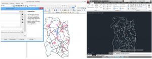
Figure 2: Exchanging data between ArcGIS and AutoCAD 3D
You will also work with raster data, being able to carry out spatial analysis, calculate continuous surfaces from punctual data through interpolation, generating contour lines, slope maps, orientations and shadings, and developing visibility studies.
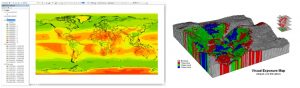
Figure 3: Obtaining annual radiation through interpolation and visibility study of a territory.
We will show you how to apply these concepts in hydrological analysis to obtain basins, calculation of volumes and modification of Digital Terrain Models.
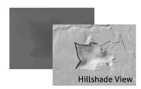
Figure 4: Introduction of a quarry in DTM
You will learn to represent this generated information in a 3D scene, which will significantly improve the final result of your analysis.
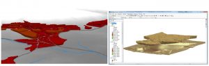
Figure 5: Representing in 3D a visibility study and volume of extracted soil by a quarry.
You will be able to use Model Builder to automate ArcGIS tasks, saving you time.
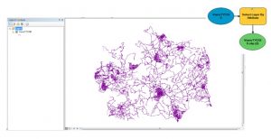
Figure 7: Automating Model Builder tasks
Lastly, you will learn to manage the Network Analyst extension for network studies (transport, electric or water piping), being able to make advanced calculations on optimal routes between two given points, influence or service areas in the network, or find the closest installation to a series of elements that we will be defined according to our needs.
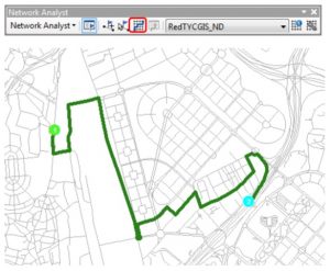
Figure 8: Calculate the optimal route between two points with Network Analyst in ArcGIS.
Quality training taught by professionals


Leave A Comment