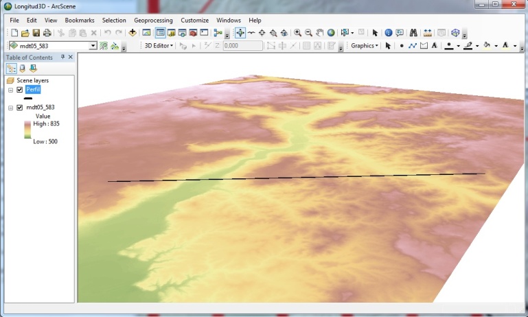
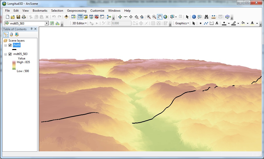
It is quite probable that for some of our analysis we will need to include the distance between two given points, measured in a straight line. We will need to value if we need to take into account the topography of the study area to calculate this data. If this is so, we can easily do this extracting the information from the Digital Terrain Model.
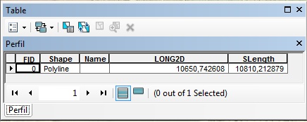
2D profile length : 10650,74 meters
This consideration is necessary as, depending on the terrain that we are working on, the difference between the measured distance without taking into account the relief and 3D distance can be pretty large.
In the chosen area to reproduce this example, this difference is 150 meters approximately in a straight line distance that is around 10,5 km.
3D profile length: 10810,21 meters
To make this calculation we will use the Add Surface Information tool, included in the ArcGIS 3D Analyst option. Previously, activate the 3D Analyst option and access to it through > 3D Analyst Tools > Functional Surface > Add Surface Information.
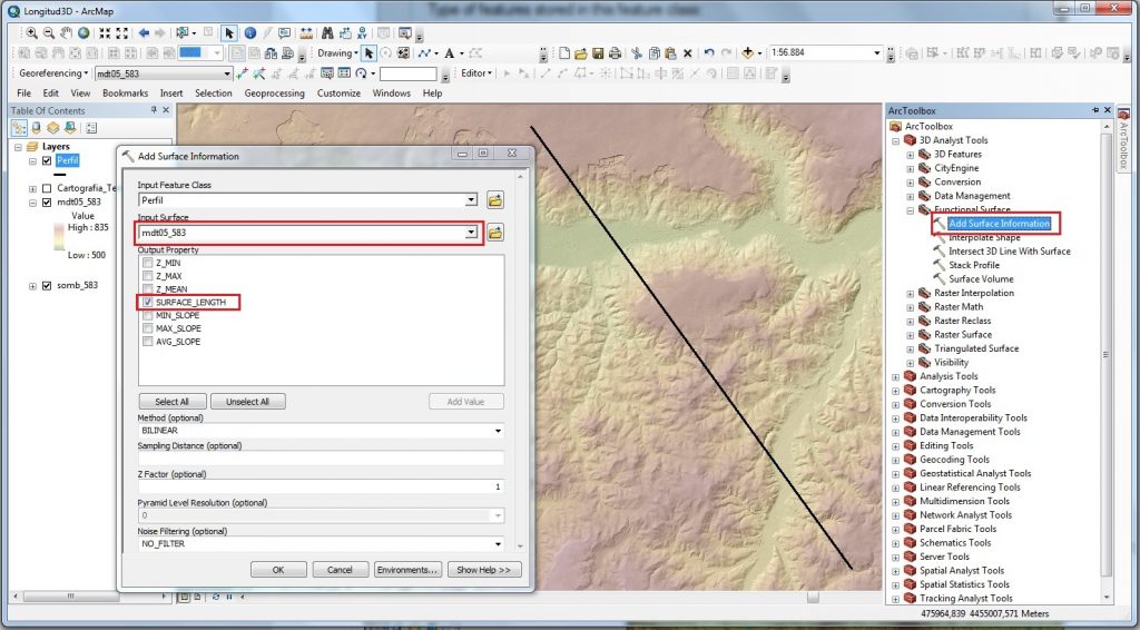
Once here, introduce the profile that we want to extract information from in vector format, and the Digital Terrain Model of the study area.
The result obtained will be the 3D distance measurement along the line defined by the profile:
Quality training taught by professionals
RECOMMENDED TRAINING COURSE


Leave A Comment