When cropping a Triangle Irregulated Network (TIN) dataset it is important that it preserves the elevation values from its edges. If not, these zones will interpolate to elevation value 0.
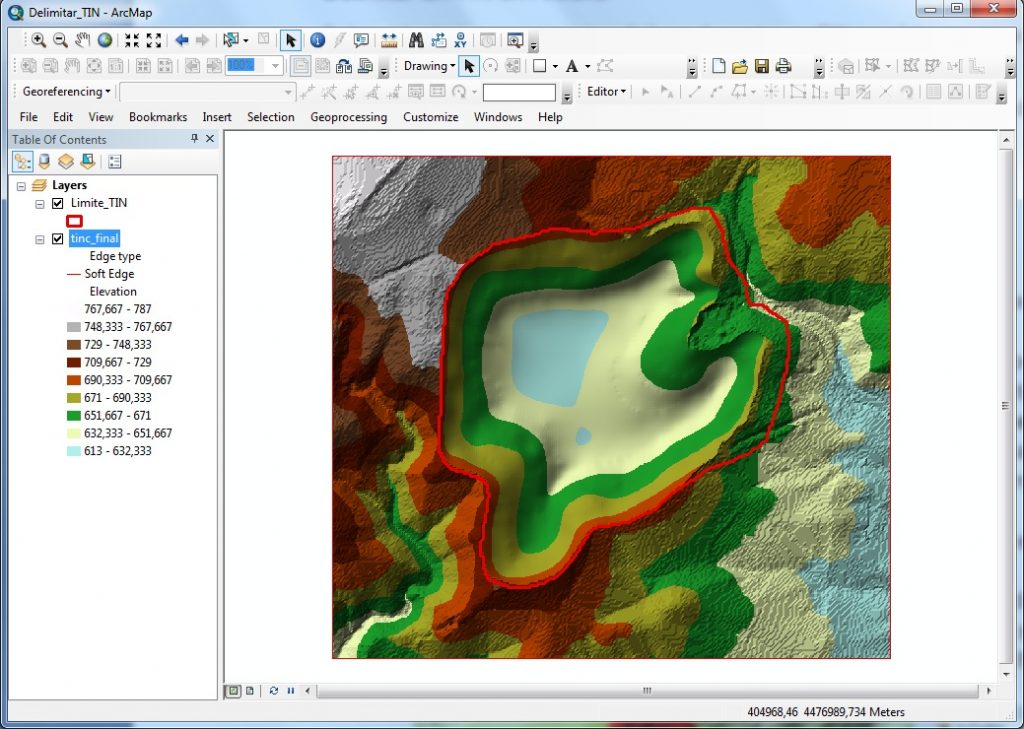
How to solve this problem? One of the possibilities is to create a polygon that includes elevation data from the Digital Elevation Model (DEM):
1. Create a polygon that will act as the limit.
2. Add the surface elevation information to this polygon using the Interpolate Shape tool.
![]() ArcToolbox > 3D Analyst Tools > Functional Surface > Interpolate Shape
ArcToolbox > 3D Analyst Tools > Functional Surface > Interpolate Shape
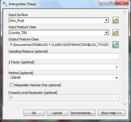
3. Add the fields as shown:
- Input Surface: the TIN that we want to delineate (tinc_final)
- Input Class: the limit polygon (Limite_TIN)
- Ouptut Feature Class: Specify the directory and output exit name of the interpolated polygon
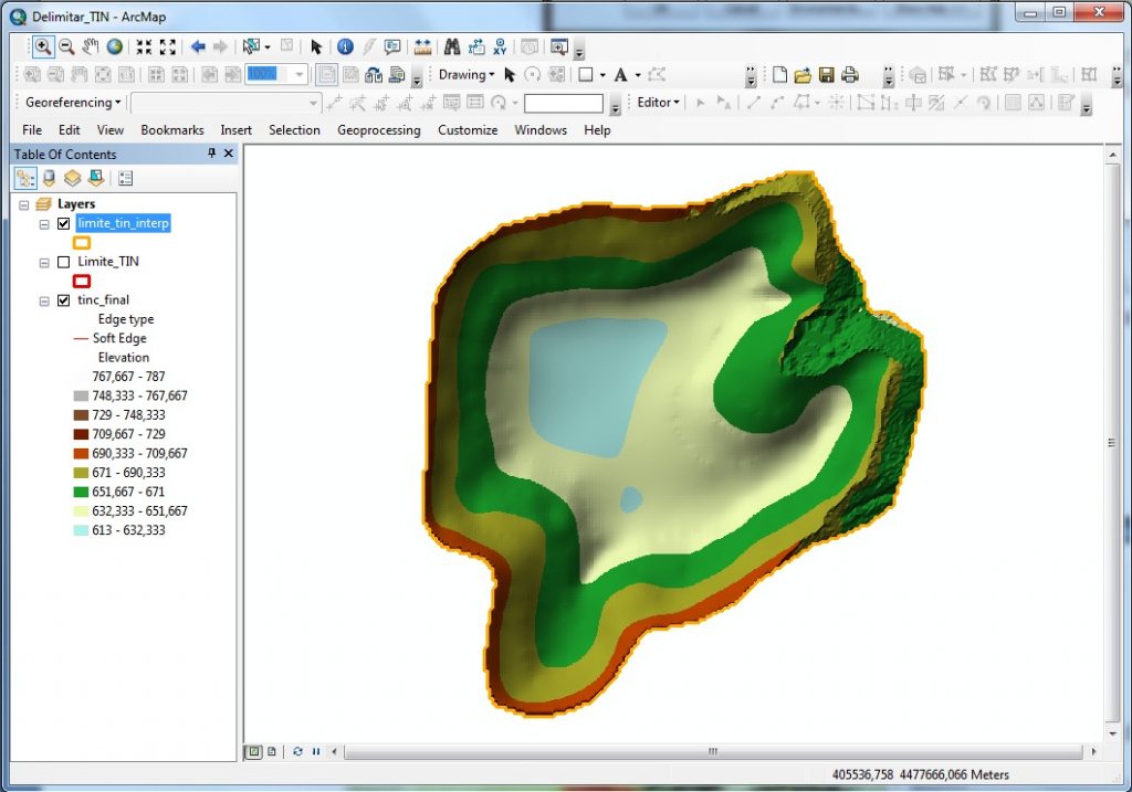
4. Cut the TIN with the Edit TIN tool
![]() ArcToolbox > 3D Analyst Tools > Data Management > TIN> Edit TIN
ArcToolbox > 3D Analyst Tools > Data Management > TIN> Edit TIN
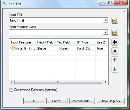
*Before applying this tool, it is recommended to create a security copy of the initial TIN to avoid losing information if the editing result is not the desired.
5. Input TIN: the TIN to delineate (tinc_final)
6. Input Feature Class: the interpolated limit polygon (limite_tin_interp)
- Indicate the SF type as Hard_Clip. This means that it uses it as a clipping to delineate the TIN.
Quality training taught by professionals
RECOMMENDED TRAINING COURSE


Leave A Comment