The first part of every project is to find out where to download the best quality of data. In this post, we show some fundamental notions to start to look for this kind of data.
1. Spatial Resolution: This is refered to a pixel size, in terms of ground dimensions. For instance, 30 meters of spatial resolution means that a pixel represents a 30m x 30m area; If the pixel has a rectangular shape and it represents a 56m x 79m area; and if we want to use a minimum size observation on the map (for 1 Ha – 100m x 100m ) a 30m of spatial resolution could be enough. Nevertheless, if it is necessary to identify tree’s tops, 3m x 3m aproximately, a resolution of 1m is required. So that the study area must be well-defined in relation of the satellite band.

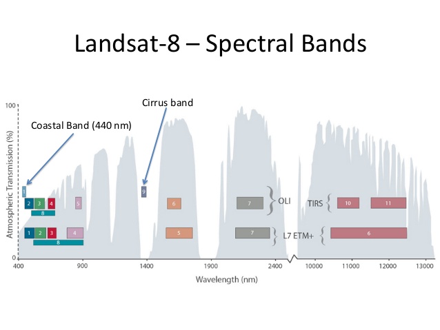
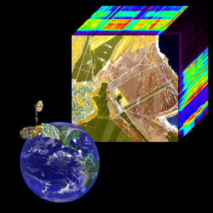
2. Spectral Bands: Spectral Values of an image depend on three main characteristics: Number of bands, Situation of Bands (in terms of graphics) and Width of Bands. Then, depending on the study carried out (ground humidity, deforestation, etc) you will need to use an specific type of Band. This is provided by sensors, locating and classifying bands within the spectrum. There are specialized sensors for concrete functions. Finally, the width of Band corresponds to the group of wavelengths that it has. Number of Bands is also important, because it depends on the kind of classification of Bands (sometimes three Bands are enough; in other cases, we need more). Hyperspectral images displays more than 100 Bands.
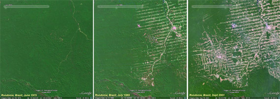
3. History or Program (also said, mission) of a concrete satellite: WHEN the program started and if it has already finished. This is quite important for temporary studies. We can make huge mistakes, for instance, if we are carrying out studies of deforestation evaluations in a concrete place, as the satellite stopped providing images five years ago… Then, it is highly important to know how long a satellite program takes.
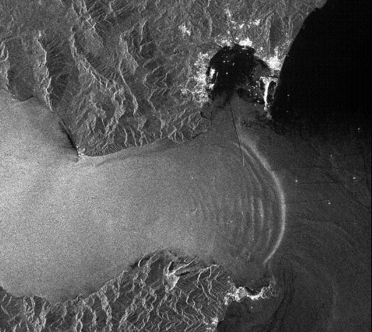
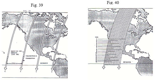
4. Period of the satellite: This is related to the orbit the satellite uses. This is also called temporary resolution, and it is quite useful in studies of flooding detection. In this case, we will need high temporary resolution images. For instance, Landsat goes through the same point every 16 days taking a relative low temporary resolution. Some other satellites can modify the angle of the camera in case of not having a vertical position from the image area (Quickbird).
5. Costs: The more reolution and quality an image has,the more expensive it is. Of course, there are many free images, available for a wide user community.
Prices could be $ 50 /square kilometer, but multispectral images are more expensive.
We hope that this information has been useful for you.
Are you interested in GIS ? Please, contact us: training@trabajosyclasesgis.com
We are a Spanish company specialised in GIS and environmental consultancy as well as GIS Training.
Fill our form and you will have more information:
http://goo.gl/forms/My0SeJQ7iH


Leave A Comment