About Alfonso Noriega

Licenciado en Ciencias Ambientales por la Universidad de Almería y Máster en PRL en las especialidades de Seguridad, Higiene y Ergonomía. Cuenta con varios cursos en materia de SIG, CAD y Topografía. Ha desempeñado labores de Codirección en proyectos fin de carrera y de Técnico Superior de PRL durante las fases de construcción en la central termosolar “Helios Campos de San Juan I y II”
3 08, 2015

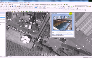
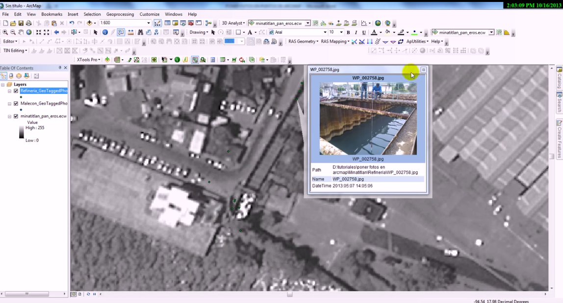
Geotagged photos to points using ArcGIS

By |2017-10-31T16:36:08+00:00August 3rd, 2015|BLOG|1 Comment

Using the tool “Geotagged photos to points”, it is possible to observe the geographic location of images through the creation of a point layer from geotagged photos. This tool reads information related to the photos coordinates (JPEG or TIFF) saved in the metadata file “Exif”. […]

27 05, 2015

Extract a raster by attributes using ArcGIS

By |2017-10-30T12:48:27+00:00May 27th, 2015|BLOG|0 Comments

There exists the possibility to select those raster cells that comply with a certain criteria based in the values adopted by each of them. To do so, we will use this simple ArcToolBox tool “Extract by Attributes” that belongs to the tool group “Extraction” in the “Spatial Analyst” toolbox. […]

Title

Go to Top