DEVELOPMENT OF WEB BASED GIS APPLICATIONS USING ARCGIS SERVER API 3.X FOR JAVASCRIPT
ONLINE TRAINING
START DATE: AVAILABLE SOON (160 hours)
PRICE: 350 € (Standard fee) | 315 € (Student / Unemployed fee)
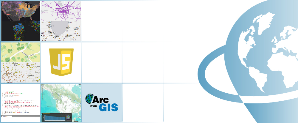
You will learn how to develop web mapping applications using ArcGIS Server API 3.x for JavaScript. Students will learn to insert spatial data in their own Web applications through ArcGIS Server map services.
Learn the fundamentals of JavaScript, the most widely used web-based programming language, learn App design and development for iOS products (iPhone and iPad), integrate through advance programming techniques, online web mapping resources like Google Maps or Bing Maps.
Enrolled students in this online course will have access to our virtual e-learning platform (which is available 24 hours), where they will find the content of the course, practical exercises, forum discussion and additional content. One of the advantages of this online platform, is that students can benefit of real time support and assistance offered by the instructor (2 hours per week), whom they can contact via direct messages, regarding course related issues, at any moment. They can also contact the instructor via email.
- Learn the fundamentals of JavaScript, the most widely used web-based programming language.
- Get familiar with ESRI Web GIS technologies in a dynamic and interactive way.
- Create your own Web based GIS Applications using ArcGIS Server and ArcGIS API for JavaScript.
- Gain experience in using ArcGIS online resources like ArcGIS Server and ArcGIS Online services.
1 - INTRODUCTION TO JAVASCRIPT PROGRAMMING LANGUAGE
2 - DEBUGGING APPLICATIONS
- What is Firebug?
- Using Console and Script tabs
- Highlighting HTML Elements
- Using CSS tab
- Debugging JavaScript code
- Error monitoring & reporting
- DOM Tab
- RED Tab
- Documentation
3 - WORKING WITH DOJO AND ARCGIS SERVER
- Introduction to Dojo
- Dijit
- Dojox
- Dojo architecture
- Integrating Dojo with ArcGIS Server
- ArcGIS Server resources
- Initialization script
- Templates
- Dojo base and Dojo core
- Type checking
- String utilities
- Array processing
- JavaScript events and Dojo. What are the events?
- dojo.connect ()
- Managing events
- Should we record all the events?
- Mouse and Keyboard Event Normalization
- Publish/Subscribe Event Mechanism
4 - ARCGIS SERVER FOR DEVELOPERS
- What is ArcGIS Server?
- GIS resources and services
- ArcGIS Server components
- ArcSDE
- ArcGIS Server editions
- What’s new in ArcGIS Server 10.1.
- What’s new in ArcGIS Server 10.3.1
5 - INTRODUCTION TO JAVASCRIPT API FOR ARCGIS SERVER
- Aptana plugin
- Short overview of JavaScript API for ArcGIS Server
- Why JavaScript?
- Working with maps
- Tiled and dynamic/feature layers’ services
- Working with map extension
- Working with graphics and graphic layers
- Feature layers
- Drawing graphics and elements
- Map events
- Info window
- Adding toolbars
- Controls (widgets)
- Editing
- Design a basic application
- ArcGIS templates
- API configuration parameters
6 - ADVANCE TECHNIQUES USING JAVASCRIPT API FOR ARCGIS SERVER
- Introduction to ArcGIS Server tasks
- Performing Spatial and Attribute Queries
- Identifying Entities
- Finding elements
- Perform geocoding and reverse geocoding
- Geometry Service
- Route Task and Network analysis services
- Geoprocessing services
- Working with spatial data
- Multiple types of layers
- com integration
- Using proxy with ArcGIS API for JavaScript
- Working with secure services
7 - GOOGLE AND BING MAPS INTEGRATION
- ArcGIS Server extension for Google Maps
- Add an ArcGIS Server Dynamic Map Service to Google Maps
- Creating a query layer
- Search features
- Identify features
- Geocoding
- Geometry Service
- Geoprocessing services
8 - ADVANCED RESOURCES OF DOJO
- Introduction
- Accessing Multiple Data Formats with the Dojo Data API
- Working with JSON
- Reading JSON Data with Dojo
- Working with XML Data
- How to read CSV file
- Ajax for client-server communication
- dojo.xhr
- Cross Domain Scripting Issues & JSONP
- Using Iframe
- JSON-RPC
- User interface manipulation using DOM
- Display a simple dialog box and store input data from user
- Advanced Dijit Selects with Dojo
- Create dynamic graphs and charts using Dojo
- Display Image with Dojo
9 - ADVANCED DESIGN TECHNIQUES FOR MAP APPLICATIONS
- User-centered design (UCD)
- KISS Design principles
- Prototypes
10 - INTRODUCTION TO USER INTERFACE DESIGN. CSS BASICS
- What is User Centered Design?
- CSS Syntax
- Comments in CSS
- ID selectors
- Class selectors – CSS
- External Style Sheet
- Internal Style Sheet
- How to add CSS styles to HTML code
- Cascading Style Sheets
- CSS Backgrounds
- CSS Text
- Font styles
- Link styles
- List styles
- Use an image as a list marker
- Table styles
- Design better data tables
- CSS Box Model
11 - ADVANCED STYLING WITH CSS
- Grouping Multiple CSS Selectors in One Style Property
- CSS Display and Visibility
- CSS Sizing
- CSS Positioning
- Overlapping elements in CSS
- Floating Elements with CSS
- CSS Image Transparency
- CSS image hover effects
12 - USER INTERFACE DESIGN FOR IPHONE AND IPAD
- Compact development (compact build)
- Initializing Display Parameters
- iOS Gestures
- Map interaction using IOS gestures
- API Geolocation
- Dojox.mobile
13 - FINAL PROJECT


Alberto Santos Estévez
Consultant and Geospatial Developer with more than 15 years’ experience in GIS integrated solutions and high performance systems.
Chencho Martín Lagunas
GIS Developer with extensive experience in Full-Stack software development, specialized in GIS data analysis and pre-processing using Python.
Why starting to study ArcGIS 10.x?
The usage of Geographic Information Systems (GIS) is rapidly growing, becoming an essential tool in a variety of business sectors like engineering, environment, geography, mining or geomarketing.
Among GIS tools, ArcGIS is one of the most used GIS software worldwide, the most stable and versatile, comprised by a set of integrated applications, with a solid documentation over a wide range of tools being also supported by a large community.
ArcGIS provides contextual tools for data visualization, mapping and spatial analysis, connecting and combining information from varied sources (local and online), offering complex capabilities in order to explore, gain and enquire knowledge, that will lead to the best decisions. It can be also handled using a user interface as well as in command line using specific programming languages, like Python.
Do I need previous knowledge in ArcGIS 10.X?
Yes, for undertaking this course you will need previous Geographical Informational Systems training and knowledge.
I do not have ArcGIS 10.x software. What can I do?
ESRI (creators of the ArcGIS program) provides a free trial license for a 2 month. You only need to create an account, download the program and follow the installation steps (see the website). However, we will assist you in any problem you may encounter.
Our online courses, are distributed via Moodle, the world’s most popular learning platform. It is a highly flexible Learning Management System that can be used to conduct and access courses, accomplish tasks of practical exercises, interact face-to-face to the teaching staff or benefit of support and resources at any time.
The online platform can be accessed 24 hours a day, in which the student will be able to ask for help at any given moment. The instructors will act as supervisors during all the training process, offering support for any possible difficulty encountered by the students along the course.
The course is structured in different modules, making it easy for the student to search for training material, download information, complete practical exercises and take assessments in order to verify their new gained abilities. The instructors will assist the students throughout all the course period, offering progressive help and information according to their evolution.
350 € (Standard fee) / 315 € (Student / Unemployed fee)*
*To enjoy this discount, you must include a copy of a document that proves your situation along with the registration form.
** If you want to know the price in other currencies, you can consult the following online converter: The Money Converter

Step 1. Request your registration to the training course completing the pre-registration document (Registration Form) and send it via email to training@tycgis.com.

Step 2. As soon as we receive it, we will send you an enrolment guide with the complete information to enroll in the course: dates, schedule, software needed for the course and the installation guide. The payment methods are included in this document.


Step 4. Once we receive the receipt, we will confirm your registration to the course via email.


NATIONAL WIRE TRANSFERS (INSIDE SPAIN):
ACCOUNT NUMBER: 0049 1809 222710347481 (Banco Santander)
BENEFICIARY: TYC GIS Soluciones Integrales SL
SUBJECT: “Student Name” and JAVASCRIPT 3.X COURSE ON
INTERNATIONAL WIRE TRANSFERS:
BANK NAME: Banco Santander
BANK ADDRESS: Glorieta Ruiz Jiménez 1, 28015 Madrid (España).
BENEFICIARY: TYC GIS Soluciones Integrales SL
BENEFICIARY ADDRESS: Calle Fuencarral 158, Entreplanta, Oficina 16-17 28010 Madrid (España).
ACCOUNT NUMBER: ES90 0049 1809 222710347481
SWIFHT: BSCHESMM – IBAN: ES90
If you have payment difficulties, contact us

 (18 votes, average: 4.83 de 5)