The United States Geological Survey, USGS, is an organization of the United States government that provides reliable information regarding the status, threats and condition of the Earth, being the largest mapping agency in the country. It shares information from all around the world.
![]()
USGS offers a variety of geological information on its website available to the public.
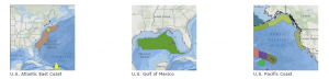
In this post we want to highlight a server of interactive maps using marine and coastal geological data of the US and the Gulf of Mexico.
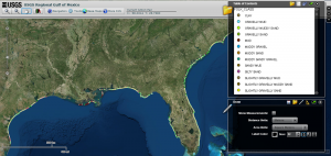
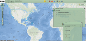
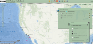
On its website you can access the Coastal and Marine Geology Program (CMGP) where you can observe, edit and analyse maps of the US Atlantic East Coast and Pacific Coast, as well as of the Gulf of Mexico that gather data from different geological mapping surveys.
You can also find other interactive maps of different research projects that study issues such as Shoreline Change, Coastal Vulnerability or Sea Floor Stress and Sediment Mobility.
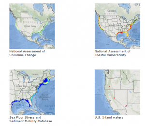
Visit the Coastal and Marine Geology Program to view these interactive maps here.
Quality training taught by professionals
RECOMMENDED COURSE


Leave A Comment